Backpacking in Grand Canyon - Clear Creek Trail - May 2011

Grand Canyon –Five Nights Backpacking in May 2011

See the full set of photos by clicking this link

On Sunday May 22, 2011 four of us descended from the South Rim on the Bright Angel Trail. Our destination was ultimately Clear Creek some 18 miles away in a side canyon where few others would be.

Packed alongside multitudes of lightweight camping gear and particles of food was a waterproof hiking journal to document our stats and trail conditions and thus four months later the trip report is complete.

Sun 5/22, DAY 1:
Starting Point: Bright Angel Trail
Trail link: http://www.nps.gov/grca/planyourvisit/upload/Bright_Angel_Trail.pdf
Destination: Bright Angel Campground @ Phantom Ranch
Miles Covered: 9.6 miles
Elevation Loss: 4380’ elevation loss
Hiking Time: 5 hours and 15 minutes (Left at 9:45 am and arrived at 3pm)
Pack Weight: 40-45 lbs.
Temperature: 65-85°
Sky: Clear
Precipitation: 10% chance but nothing accumulated.
Wind: ~23 mph gusts
Difficulty: 3.5 out of 5
Water Availability: Plenty of sources along the way at maintained waterholes.

Trail Conditions: Bright Angel is a corridor trail, making it very popular and dense with tourists especially through the first half of the hike. Hikers, runners, tourists, horses and mules use the trail and as such it is very well-maintained and allows you comfort that if you twist an ankle someone will be along soon. The trail is steep but as long as you put one foot in front of the other and stay on the trail you have good probability of making it to your destination.

Notes: On the trail, time doubles (or seems like it anyway) from stepping out of the way for uphill hikers. We saw several horses on the trail which is a rare sight, usually only mules use the trail. We stopped at the bathrooms that are halfway to Indian Garden and then again at Indian Garden.

Since we hike at different paces Richard and I carried walkie-talkies for the first time, they had great reception and even picked up outlier conversations from the rim all the way below Indian Garden.

3 of the 4 of us ran out of water by not anticipating the amount needed to fill at each water station. We ran out right by Silver Bridge, so we only walked about 10 minutes before reaching the pump on the north side of the bridge. Richard was way ahead of us at the end and came in really handy when I radioed him that we were out of water – he was able to fill up a canteen and bring it to us as we crossed Silver Bridge. Vanessa was the only one of the four of us who had water in her bladder.

We camped at spot #3 in Bright Angel Campground. We saw squirrels but our new Outsaks and camp selection kept them at bay. The year prior we learned the squirrels are diligent in their scavenging and will climb trees, poles and probably even people to get to the snacks they desire (they are especially keen on anything with a nutty aroma).

Once we settled Richard picked up his fly rod and caught a brown trout with a dry fly tarantula pattern with a parachute topsize #12.

Mon 5/23, DAY 2:

Starting Point: Bright Angel Campground
Trail Link: http://www.nps.gov/grca/planyourvisit/upload/Clear_Creek_Trail.pdf
Destination: Clear Creek Campground
Miles Covered: 8.7 miles
Elevation Gain: 1250’ elevation gain (HOWEVER, please note we gained and lost multiple times, aggregated together we probably gained at least double this)
Hiking Time: 7.5 hours (Left at 9:30 am and arrived at 5pm)
Pack Weight: 48-53 lbs.
Temperature: high 80s on trail, 70s at camp
Sky: Cloudy (thank God)
Precipitation: rain in the night with thunder and lightning
Wind: very gusty
Difficulty: 4.5 out of 5
Water Availability: NONE

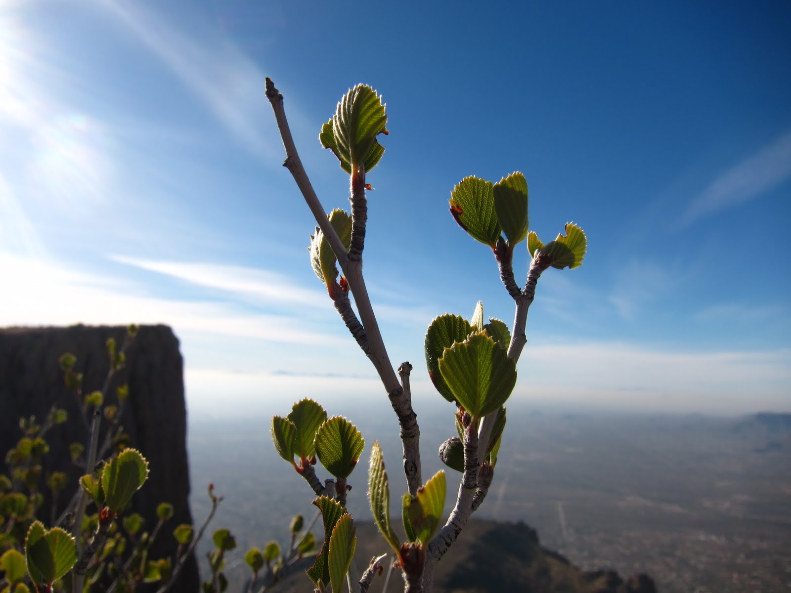
Trail Conditions: The first half of Clear Creek trail is easier and better maintained than the second, undoubtedly because it’s more traveled. There are panoramic views everywhere; nearly every 100 feet could be a scenic viewpoint. The last half of the trail was eroded and overgrown desert. We followed the cairns with ease though. There is no shade, so the clouds overhead were incredibly appreciated. The last quarter of the trail is exposed, slightly scary at times when the wind gusts blew our tired bodies towards the loose ledges that could vaguely be called trails.

Notes: The guidebooks and trail descriptions say Clear Creek is just 1000’ above Phantom Ranch, but what they fail to mention is that you gain 1000’ multiple times and lose several hundred at a time going up and around washes and ridges. There are endless ridges. This was a very difficult foot stomper hike with 50 pounds on our backs. We saw 5 people on the trail – 4 of them came on the first half and the 5th showed up at camp. The last quarter mile was very steep and shaley. It seems the trail was established some time ago and now it’s overgrown. You could slip or fall at several places and we would not recommend this for kids or inexperienced hikers. A mule could not make the last quarter of a mile of trail (at least we don’t think it could). With that said, it is incredibly beautiful; temples loom above in every direction. The hike is long. We think it’s best to plan for several days at Clear Creek in order to provide enough quality time to not only recuperate but to experience the beauty of the creek and area.

Tue 5/24, DAY 3:
Starting Point: Clear Creek Campground
Destination: river hiking and back to camp
Miles Covered: Creek goes 5 miles to Cheyava Falls, we went about 1 mile before seeing a naked man and turning promptly around.
Elevation Gain: 1275’ to Cheyava Falls, I doubt we even gained 500’.
Hiking Time: 1:30 (Left at 1:30 pm and arrived at 3 pm)
Pack Weight: 10 lbs.
Temperature: 80s
Sky: Mostly clear with occasional clouds
Precipitation: none
Wind: gusts up to 40mph
Difficulty: 1 out of 5
Water Availability: everywhere, but bring a filter.

Trail Conditions: River hiking. Rocks were solid not slippery. Water was below knee-level the entire time. Overgrown plants lined the river’s edges. We took hiking sticks to help balance our footing. Water shoes are a definite. I used my 5.10 hiking shoes with neoprene socks and then dried them on a tree the next day (this saved me weight and space as I didn’t need to carry a separate pair of shoes).

Notes: Water filter is necessary at Clear Creek Campground and be warned that it could clog by gravel.

We were asked to pack our poo by carrying Disposal Johns in and out of the park and report back on our experience. 2 of the 4 of us attempted Disposal Johns while the other 2 opted immediately to dig catholes. 1 of the ones who attempted it, quickly changed her mind and adopted the cathole method. This brought up hours of campsite chatter as we marked our territory and discussed the history of ancient pooing techniques. What is the history of sewage? Was it used for crop fertilization? Did each family have their own rules or were there common practices for entire tribes? Overall Disposal Johns had a low satisfaction rating among females for many reasons, which, if you’re interested, I can tell you all about in a more private setting, just email me.

Wind was sporadic and picked up around 10 am. We had to be vigilant in securing the fly, using large rocks to fortify the stakes. We saw two new hikers and one of us saw a naked guy’s hairy nether regions. We also saw frogs and lizards. We learned that ants like margarita mix. We read, as a group, 140 pages of The Man Who Walked Through Time by Colin Fletcher. The creek was used to cool our beverages by roping the beverage bag up to a tree. Our Outsaks (aka ratbags) made it through the night buried under rocks with no issues, no critters, and no ants marched near. A great way to refresh ourselves was to rinse our clothes in the creek and dry them on a rock. Alcohol and/or peroxide were used routinely to treat our blisters and kill the gunk build up. In order to prepare for the hike out and to try to carry the lightest pack possible we began sorting and eating our food based on its weight. Lesson learned: eat all the heavy dinners first. The rest day was hugely impactful to our quality of life and our trips out.

Wed 5/25, DAY 4:

Starting Point: Clear Creek Campground
Destination: nowhere
Miles Covered: zero
Elevation Gain: Less than 10'
Temperature: 90s, very hot at noon
Sky: Clear
Precipitation: none
Wind: light, with a few gusts after 5pm
Water Availability: everywhere, but bring a filter.

Notes: We slept with no rainfly the night before in order to make the most of the breezes and enjoy the desert sky. In the heat of noon, under the canopy of cottonwoods I was lulled to a napping state by the sparkling of their leaves. While one of us was doing his “business,” he saw a snake. Our campmates moved their tent due to an ant infestation.

Our first fuel canister (for two of us) was done before lunch- we had used it 8 times and think the Primus pan was a great fuel-saver as it expedited the boiling point tenfold. My last dinner at this camp was a menagerie of dried food choices – mashed potatoes, corn and red pepper pasta – as I tried to eliminate all the heaviest items from my sack without sacrificing calories for the next day. Katmandu Curry with 64 grams of fiber may not have been the right choice – next backpack trip will have new requirements when it comes to selecting dinner options. Louisana Rice and Beans had a lot of fiber too. The recommended daily allowance is only 25. Richard continued to use the Disposal Johns and says that the enclosed wipe was dry.

Camp shoes are recommended – flip flops or Tevas specifically. Richard loves his hiking boots and continues to wear them every chance he gets as he has no blisters at all – the Soloman XA Pro 3D Ultra Gortex (not for use IN the water though). We saw zero people all day. 2 crows circled and squawked. The Razos continued to have water filter woes with gravel tripping them up. We talked of invented a folding titanium pot, a camping dominoes set and a commode.
Another question we pose today is what are the black worms in the water? We invent species for them and think they are baby leeches. They are in fact black fly larvae. We wonder why there are no fish in Clear Creek—later we learn the creek drops off downstream and the fish can’t swim up it. The frogs that sound like sheep that begin to make noise in the later afternoon also entrance us. Later we identify them as Canyon Tree Frogs.


Thu 5/25, DAY 5:


Starting Point: Clear Creek Campground
Destination: Bright Angel Campground
Miles Covered: 8.7 miles
Elevation Loss: 1250’ but we gain and lose all day.
Hiking Time: 5:30 (Left at 6:05 am and arrived at 11:30 am)
Pack Weight: 35-40 pounds
Temperature: 90s
Sky: Clear but cloudy in the morning
Precipitation: none
Wind: gusts after 8am
Difficulty: 4 out of 5
Water Availability: none

Trail Conditions: It was easier going out than it was coming in. The sketchy part was done quickly as it was the first thing encountered after leaving in the morning. Since we left as the sun was rising we had some magical moments climbing up and onto the Tonto Platform.  Once up there, the wind picked up. As we crossed Sumner Wash we saw brown rattlesnake, bats and a chuckwalla hiding under a rock.

Notes: Rated the hike back a 4 for exposed areas, no water, sketchy/unstable areas, and few people. Could be a 3.7 or so but winds, sun, etc can make it much more difficult. Last night Sergio saw a cream colored snake with a pattern. Vanessa saw a pink rattler on the trail today. Richard found a brown rattler that caused us to go off trail to go around it because it was pissed. The last mile was a foot pounder!

We hit camp at 11:30 and as a group we had 12 Tecates, 3 lunch sacks, hit the clean people bathrooms, and set up camp (#3 again). Richard fished the Colorado successfully – 2 rainbow and 4 brown trout at the confluence using a parachute dryfly #12 and elkhair #14. We learned this via walkie-talkie as the rest of us who weren’t wearing “pillows on our feet” were not inclined to walk the short distance down to the River, opting instead to cool our swollen feet and blisters in the Bright Angel Creek which happened to be running alongside our new favorite campsite #3. We wandered over to the lodge area around sunset to hear about the California Condor but were too tired to finish listening and went back to camp and promptly fell asleep under the stars with no rainfly.

Fri 5/25, DAY 6:
Starting Point: Bright Angel Campground
Destination: South Rim
Miles Covered: 9.6 miles
Elevation Gain: 4380’
Hiking Time: 5:35 (Left at 7:05 am and arrived at 12:40 pm)(last hiker up at 1:45 pm)
Pack Weight: 25-30 pounds
Temperature: 80 at Indian Garden, 95 tops
Sky: Clear, no shade, no relief.
Precipitation: none
Wind: sadly, none
Difficulty: 3 out of 5
Water Availability: great

Trail Conditions: Ripe with tourists. Hot! No wind. Well-traveled trail with ruts. Red rock section never ends. Lots of mule poo to walk around. Heard the Kaibab trail is also exposed to sun with no water sources but has a great view. Some places are steep enough you could fall.

Notes: Stay away from field trips and their mothers. I stopped 3 times – at the bathroom across Silver Bridge, at Indian Garden and at 1 ½ mile stop. No trail etiquette by most – UPHILL HAS THE RIGHT OF WAY. Also need to create awareness in the hiking etiquette “STAY TO THE RIGHT.”  Richard says, “secret to hiking the Grand Canyon is one step at a time.” Seeing all the people not in shape at the top made us feel like badasses. Vanessa listened to her ipod most of the way up to get extra motivation- she would like to remember to create a metal mix next time. At the bar Richard says “the one thing all nations have in common is alcohol. We all speak different languages but get along.”

We discussed why we do this type of hiking and come up with answers such as hiking keeps us humble, allowing us to appreciate the little things like showers and plumbing. Hiking is a way to reduce the stress in our life to just the basic necessities like survival, food, water and shelter. We enjoy the accomplishment of pushing ourselves and overcoming the challenge. It’s a time to reconnect with nature and replenish our souls. And then we change the subject and discuss inventing a Propel-style beer powder before heading into the restaurant for some fried food to replenish our grease intake.

"How to Clean a Backpack" by Richard Anderson

Since I'm the one home today I get to complete the task of cleaning our backpacks (Osprey Aura 65 and REI XT 85) after our 5-day excursion into the Grand Canyon. Richard (my boyfriend) is keen on cleaning all the gear as soon as we get back in order to remove the dirt, critters, and salty sweat remnants so that our stuff can last as long as possible. Neither of us really knows if there is a "proper technique" for cleaning the gear but here are the instructions he gave me for the ritualistic cleaning of the backpack.

  1. Open all zippers and take everything out of the pack.
  2. Double check all is out of the pack. (You can leave any carabiners that are attached in place)
  3. Fill a bathtub up with warm water.
  4. Put no more than 1/8 cup of powder detergent or a little bit of liquid detergent that you would use to wash your clothes in the tub and run your hands in the tub water to dissolve all the detergent.
  5. Put the packs in the tub and completely submerge them. Let sit for 10 minutes.
  6. Go back and vigorously agitate both packs and use your hands to scrub the padded areas.
  7. Resubmerge packs for another 5 minutes.
  8. Again vigorougsly reagitate both packs and pull the packs out of the tub.
  9. Drain the tub.
  10. Refill the tub with fresh warm water.
  11. Put both backs back into the tub. Reagitate both packs to remove all detergent.
  12. Empty bathtub water and repeat steps 10-11 again.
  13. Take packs outside and hang them up to dry.
Viola! Clean packs.

Today's Hike: Camelback via Cholla Trail


Since I'm still prepping for our 5 night backpacking trip in the Grand Canyon I figured today was another great day to take advantage of the beautiful weather (can't beat 80s in May in Arizona!) and hike up Camelback.

I first stopped at the trailhead at Echo Canyon but realized I wasn't the only one trying to hike. The parking lot was full. The rangers were out again just like they were last week, several service vehicles were up there, making me think they're taking extra precautions to monitor the area since a fatality occured a few weeks ago.

Instead of wrangling with the parking situation at Echo Canyon I buzzed over to Invergordon to see what the other side of the mountain had going on. I was in luck, I parked just a couple blocks from the Cholla trailhead and got my hiking groove on.

I find it interesting that there are no rangers or service people on this side of the mountain. Does that mean it's safer? Less popular? Harder to access?

Anyway, up and up I climbed, passing a few people and getting passed by others. For some reason I think this trail is easier than Echo Canyon because I didn't stop at all on my way to the top today. Last week, I rested several times on the other side. I think Cholla provides some breaks in the intense steepness of the trail that Echo Canyon does not, because in actuality my heart rate monitor told me that it took me just as long to hike the Cholla trail, my average heart rate was equal to that of the other trail, and my max heart rate of 188 was actually higher (by two points) than it was on Echo Canyon. So I think, in reality, they're about equal in difficulty. I do think you're more exposed on the Cholla Trail for longer periods of time than on Echo Canyon. Echo Canyon is pretty much a boulder scramble but for the most part you are secure within the canyon walls and not exposed on both sides at any given time.

On the way up Cholla trail today, when the trail gives way to its own boulder scramble, navigating your way can be a little difficult, especially if you're new to the trail. A couple with British accents (I think) were ahead of me for some time and had several doubtful moments where they doubled back and lost the trail. Once I helped them realize the blue dots were there to help them find their way they were back on track and made it to the top after negotiating away from a rock wall in favor of a hidden dirt path to the south. Good for them!

At the top I was greeted by more than a dozen others. Someday I hope to get the Cheers! treatment when I get to the top of a mountain, where everybody up there knows my name and recognizes that it's my bar stool on top of the mountain!

I barely rested before heading back down, because I was hoping to get back down quickly since I had had to pee since I got to the trailhead. FYI- there are no bathrooms on the Cholla side and I was unable to find a secluded place where I felt comfortable dropping my drawers, so I sucked it up and hoped the pee would evaporate in my bladder. That didn't happen.

On the way down, I nearly stepped on Rico the chuckwalla when I side-stepped on a rock to give the right of way to the uphill hikers. They stopped with me to take some photos (and name him) before heading off to the top.

Farther down, below the saddle, I ran into a pair of hikers in distress. Two girls in their 20s, who had probably hiked the trail many times before, were stopped because one of them tripped. Her knee was torn open and bleeding quite a bit. I didn't see the fall and she had just poured water over the wound but the blood flow was pretty strong. It was a perfect time for my first aid kit to make an appearance. I have never had to use my first aid kid outside of blister therapy on backpacking trips, but today, it had its first shining moment. Neosporin, Gauze, tape, and whatever else they dug out of there to stop the bleeding. The girls were just below the saddle and the bleeding one hoped she could make it there before heading back down. I didn't wait around but I certainly hope they made it back okay.

To find out what's in my first aid kit, check out What's in your first aid kit?

To read more about the Cholla trail check out my info blog at: Cholla Trail

What's in your first aid kit?

In my first aid kit you will find:
  • Neosporin: Neo To Go! packets
  • Waterproof Adhesive Tape: 10 yards
  • Q-tips for applying ointments
  • 3x3 inch Sterile Pads
  • Pro-Air inhaler (I have a mild case of exercise-induced asthma)
  • A syringe for cleaning wounds/blisters with water in a more effective manner
  • Antihistamines (Zyrtec and/or Benadryl)
  • Advil (use little ziploc bags that buttons come in on dress pants/skirts to hold pills)
  • Tums
  • Water-Jel Burn Gel packets
  • Neosporin Lip Treatment
  • Alcohol prep pads
  • Band aids of various sizes
  • Tweezers
  • Tiny circular Velcro pieces (to create a fastener, if needed, on a wrap)

What am I missing that you carry in yours?

Brown's Trail #133 @ Four Peaks Wilderness

BROWN’S TRAIL #133 (FOUR PEAKS WILDERNESS)

Brown’s Trail #133 is within the Four Peaks Wilderness area in the Tonto National Forest. The trail technically ends at Brown’s Saddle just below Brown’s Peak, the tallest and north easternmost of the four peaks, appropriately known as “Four Peaks.”

Links:
Tonto National Forest Website
Todd's Hiking Guide
Hike Arizona website

One-Way Mileage to Saddle: Approximately 2 miles.

Elevation Gain: ~1000 feet gain from the trailhead to the Saddle and another 1000ish feet gain to get to the top of Brown’s Peak. We went above the saddle but below the peak and achieved a top elevation of around 7300 feet.

Top Elevation: Approximately 6760’ at the saddle and 7660’ on Brown’s Peak.

Experience Needed: Hiking on steep trails which are sometimes fairly exposed to wind and drop-offs. If you’re afraid of heights or have trouble with steep hills this may not be for you. If you choose to summit Brown’s Peak you will need to be able to scramble boulders 10-15 feet high several times.

Difficulty: Listed as “more difficult” on the Tonto National Forest website.


Parking: Park at Lone Pine Saddle Trailhead, which is up FR143 via a 19-mile
dirt road. You should not attempt this without having a high clearance vehicle able to withstand an hour’s worth of bumping and grinding. It’s not a difficult 4x4 road but it’s not made for your standard Honda Civic. 4 wheel-drives may not be a necessity but it definitely is a plus. Some people park at the bottom of the junction off SR87 and then use ATVs or other recreational vehicles up the road. Here’s a photo of the cars we found at the trailhead – use this is a guide for what type of car is needed to get there.

Pets: We brought our mascot, Lucy the golden doodle, with us but she was the only pup we saw. And we turned back before finishing the Brown’s Peak hike due to safety factors from both the standpoint of Lucy’s capabilities and the big wind gusts we experienced that day.

People Meter: I found this to be a comfortable level of people. We passed several large groups going up or down and a few other folks but mostly we had the trails to ourselves.

Safety: We took along our walkie-talkies for the first time and were within range of each other the whole trip. We were also able to hear other conversations on our radio frequency. To me this indicates fairly decent safety since we were within range of getting additional help if need be. BUT, the hike is difficult, so be ready for a heart-pumping experience. My heart rate topped out at 186 at some places as we hiked to the saddle. Be sure to watch your footing, and hike with a buddy. Also- just because you’re in range of getting help, remember that you’re an hour into the wilderness, so it will be a fairly long time before you’re able to get medical attention. So be aware and safe! Remember getting up is optional but getting down is mandatory. Do NOT climb up anything you don’t think you can get back down!

My Experience: We intended to hike Brown’s Trail to the summit on May 15, 2011. We headed out with a late start from Cave Creek around 9:45. In our Jeep, the three of us and our mascot headed out to SR87 and then up the dirt road FR143. If you take a dog with you, I recommend a harness or some way to strap your pooch in. Lucy was anxious and had a few brain scrambles as she was knocked around between the seats over the bumpy 19 mile drive to the trailhead. Once at the trailhead we were so focused on hiking we didn’t even stop to verify which trail we took. A trail sign was there but it was blank – just wood, no sign. So we luckily chose the path we wanted to be on, but it’s a big reminder to start off on the right foot and trail! The hike quickly gains in elevation as you twist up and around, through foliage and rock. Richard quickly gained traction and was 15 minutes ahead of us but still reachable by walkie-talkie. He waited for us about 5 minutes below the saddle near a big rock with a great view of Roosevelt Lake.

At the saddle we stared up at Brown’s Peak and put away our hiking sticks. The rest of the hike would need our hands and feet to get there. Lucy the dog is like a billy goat but after several minutes of climbing we faced the crevasse of the tall rock wall we’d need to scramble up before summiting. That, coupled with the 40+ mph wind gusts, made us rethink our stopping point for the day. We had already hiked two hours and were happy with our progress, so we decided not to push it and to put the hike on our schedule for June. We watched some hikers get to the top through our binoculars while we sat and rested, refueled and headed back down.


On the way down we noticed what we thought was a camp fire in the distance had turned into something a bit more ominous. Richard called and reported it, we were not the first to call but they were appreciative of the call. As we drove back out FR143 we drove right by the area and the fire service was already on scene hiking out to contain the damage. We saw several planes fly by and one dropped a powdery red-orange substance out on to the area.

It was a fairly small fire as forest fires go, but the winds were high so hopefully they’re able to stop its expansion fast!

For more photos and information about this trip and other things going on outside in Arizona be sure to "like" OutsideAZ on facebook.

Why you need a hydration pack...

I just got back from Carmel, California yesterday. We were there for my brother’s beautiful wedding --beautiful sheep field overlooking the ocean, beautiful 55 degree weather, beautiful people full of love for the couple, beautiful words spoken at the ceremony. At the ceremony the pastor told the story of my brother and his new wife – how they fell in love hiking trails throughout Northern California. That’s a similar scenario for me. One of the main things my boyfriend and I have in common is our love of hiking and traveling and soaking in the scenery wherever we can find it. I also love hiking because of the feeling of accomplishment after a hard uphill stretch, and the reflection and introspection you’re rewarded with on long hikes.

Since I had the day off today I decided to hike Squaw. My emotions were still boiling below surface and I knew a hard hike would help me work through my thoughts. I arrived at the trailhead at noon and got started. I was about halfway up when I remembered “Hey, this is NOT Carmel. You are in the desert. In the noon sun. And you’ve only had a bowl of cereal.” I had to stop three times on my way to the top because I was still living in fantasyland and didn’t mentally prepare myself for the 90 degree Arizona sun. So much of hiking in Arizona is a mental challenge. You need to know your body, and know what to give it when it reminds you to pay attention. I had my small hydration pack with a 70 ounce water bladder so I was able to water myself at every turn. I had on my sunblock and a hat, but wore a tank top so my arms heated up quickly. There was no shade. And honestly, it wasn’t really THAT hot, as far as Arizona hot goes, but I didn’t think about the fact I was sitting at sea level yesterday with plenty of shade and it was only 50 degrees but 80 percent humidity. Hello, Arizona tourist. I had to quickly recalibrate my body and mental state to the fact it was now desert mountain time and I should have eaten more than I did. Lucky for me I keep a stash of power bars in my pack.

A lot of other people along the trail also had trouble with the heat. Which is why I’m writing this now. I highly recommend that if you want to hike any of the Phoenix area trails you get yourself a hydration pack with a water bladder and storage for the “just-in-case” moments. I’ve been on Squaw when one of the people in our party started getting dizzy and seeing blank spots, this is typically caused by low blood sugar due to exertion. You need to rest, eat something and hydrate. This happened to me today, as it sometimes does on long hot hikes. Many people might not know how to handle this. Don’t push yourself so hard you puke. Don’t push yourself so hard you pass out. Stop, wait for your heart to slow down. Sit in shade if you can find it, even a little bit of shade is good, or facing away from the sun if you have no other options. Eat a few bites, you may not be hungry but it doesn’t matter. You need some nutrients to help your body rebalance itself. When you get up, be realistic with yourself. Can you make it to the top? If you can’t, turn around. As Ed Viesturs says ---“Getting up is optional, getting down is mandatory.” Don’t be a liability to your hiking partners, others on the trail or yourself. Be prepared, be realistic, and be in tune with your body.

I ate half my power bar while I sat on a bench with shards of shade, facing away from the sun. I waited for my heart to slow, I waited until I felt better and then I waited a few minutes more. When I got back up I took it slow; if you start back up the steep steps too fast you’ll just head right back to where you were. I stopped one more time in a tiny bit of shade of a rock, right before a steep climb up steps before the last bench before the top. I took two more bites of my power bar, and finished my climb about ten minutes later.

The reward of finishing is very satisfying, but I knew that if I truly didn’t feel I could finish I would have turned around. I don’t want to be the one they call the helicopters for. I don’t want to be the cause of an emergency call to my folks or boyfriend. I feel an obligation to think twice and listen hard.

So anyway, my recommendation is a hydration pack that has a hole for the drinking tube of your water bladder. Some models come with the bladder and some come without, so be sure to know what kind you have. You can get hydration packs at most sporting goods stores. Try REI, Big 5, Sport Chalet, or Cabela’s. My pack is an Outdoor Products model I purchased probably ten years ago but there are many other brands you can choose from (Camelbak is the most popular). I purchased mine maybe 10 years ago, and I use it on every city hike. These packs are small, maybe 18-24 liters at most. Mine is lightweight but provides me a place for my keys, my first aid kit, my 70 oz of water, my emergency snacks and my phone. And it keeps my hands free so they can grab rocks, tie shoes, catch falls, and pet lizards.

I think this is mandatory purchase for any regular hiker, walker or biker or those that aspire to be regular mobilists.

Leave a comment and let us know what you carry on city hikes.

Happy hiking!

Thunderbird Park: 59th Ave, North of Deer Valley Road

The City of Glendale website lists all the trails available at Thunderbird Park: Glendale's Thunderbird webpage

At the 59th Avenue entrance, there are multiple picnic areas, covered ramadas and parking access for most of the trails.

Source of Map: City of Glendale, Photos/Art: Amy Bartlow
Mileage: Each trail intersects with another, so it's likely your hike will cover sections of more than one trail. For context looking at the map above, trail H-1 is 5 miles in entirety, while H-3 is 3 miles. However, if you take H-3 you'll end up hiking a portion of H-1 to make it a loop.

Elevation Gain: If you're looking for elevation gain check out the topo map on the City's website. It appears that the bottom elevation at all the trailheads is around 1350'. On trail H-3a you can reach 1800'. And the top of trail H-2 appears to hit 1850'.

Experience Needed: Nothing special. Get out and walk!

Difficulty: Easy to Moderate.

Parking: For the H-3 or H-1 hiking trails I recommend you turn right when you enter off 59th Avenue and park all the way to the North end, past Ramada 8. It will seem like you’re driving into a neighborhood but the trailhead stops just short of the housing perimeter. There is an access trail leading east that will connect you with the H-3 trail. You can choose your loop direction and route, creating your own adventure.

Pets: Dogs, cats, and this park is also open to trail stock (aka horses)

Hours: Sunrise to Sunset. Gates will lock you out at sunset

Safety: Watch for mountain bikers, dogs, and snakes. There have been reports of car vandalism/theft in the past so be sure to lock your valuables up and out of sight. Take your cell phone with you on the hike. Remember as always to carry enough water, and bring a headlamp just in case you get stuck. It's not hard to find your way; visibility is great, and these are well traveled trails (I think I spent maybe 5 minutes in solitude) so be courteous to other hikers.

People Meter: On my 80 minute hike I counted nearly 50 people in groups ranging from 1 to 4. That’s about 1 person every 96 seconds. The trail is wide enough to pass comfortably, and no traffic jams ensued.

My Experiences: My hike started by turning left on the H-3 trail, heading around the park to the NW, before circling around to the NE where the trail meets up with Pinnacle Peak Road. I crossed the road at Pinnacle Peak and joined up with the H-1 trail before turning right to cross the Pedestrian Bridge to finish my loop where I started. All in all it was probably a 4-5 mile hike.

I was happy to run into a Chuckwalla that wanted to pose for the camera:

div class="separator" style="clear: both; text-align: center;">


For information and photos on the 67th Ave & Patrick entrance check out that post here: Thunderbird Park: 67th Ave & Patrick Lane

Sterling Pass in Sedona

STERLING PASS

Sterling Pass takes you through and up a forested gully of Oak Creek Canyon to a saddle before descending through Sterling Canyon to Vultee Arch. The trailhead is across 89A just up from Manzanita Campground. Word has it that the canyon was named after a local settler; however, I read somewhere that the settler was a cattle rustler and he used this pass as his getaway path. After hiking the trail I can’t imagine a herd of cattle navigating the narrow, steep parts; but it sure does add some mystery to the hike.

One-Way Mileage: The trail winds 2.4 miles through the canyon to end at the start of Vultee Arch Trail. At that point you’ll need to make a judgment call to either continue on or turn around and go back the way you came.

Elevation gain: ~1100 feet.

Top Elevation: ~6000 feet

Experience Needed: Hikers should be comfortable with steep and narrow trails. I recommend using hiking sticks for added stability and confidence.

Difficulty: Other sites rate it as anywhere from moderate to difficult. The Coconino National Forest site says it’s Strenuous. It all comes down to your fitness level and experience with narrow, steep trails. It was a huffer and a puffer. Plenty of shade, lots of switchbacks. The entry point of the trailhead was the sketchiest spot in my opinion because you must climbing up a steep trailhead in soft Sedona dirt, above the highway. Once you get up that entry point you’ll feel more secure.

Parking: The hike is located right off highway 89A so parking can be interesting. If you’re planning a camping trip, plan to stay at Manzanita Campground and you’ll have a great access point to the trail. If you are not that lucky, you can use pull-outs along the road as long as you have a Red Rock parking pass.

Pets: If cattle used to pass through here I assume dogs are allowed. The National Forest site says horses are allowed. No mountain bikes though. I could not find any other information regarding dogs.

People Meter: We saw a handful of people but experienced no traffic jams.

Safety: Hiking sticks are recommended. Bring a headlamp and snacks and water. After you start huffing and puffing your way up, it will be important to rest, drink, and refuel. Also, because you are sifting your way through the pines and maples, there is plenty of shade, meaning as dusk falls you’ll want to have extra light just in case. It will also vary quite a bit between hot and cold as you hike (we were there in November), so dress in layers.

Links: Coconino National Forest information on Sterling Pass

My experiences: In November of 2008, we were limited in time as we had to check out of the campground that day, so we did not make it the full distance, missing probably the most beautiful part of the hike, where it runs into Vultee Arch. I fully intend to get back there this year to do the full hike, as the hike up to the saddle was one of my most cherished hikes so far in AZ.


Revisiting East Wing one year later.

What a huge difference a year makes. When I first visited East Wing Mountain Loop it was February 2010 and there were nearly zero cars in the park's parking lot (see comparison at the link: 2010 post)

Today the parking lot was so full I had to park on a side street!


Luckily however all those people weren't headed to the trail I was headed to. I saw more lizards (7) and butterflies (8) than I did humans.

There's something about this trail that I really like. It's not a hard hike, it's not a long hike and it doesn't push me. But it leaves me in a really good mood. There's just enough of a push that I feel accomplished when I'm done, it's more than just a walk around the block. I think it's the fact I was able to stop and enjoy myself. I got to play with my camera without feeling self-conscious. I took more than 50 photos of a rock and butterflies and never once had to move off the trail to let someone by. Never felt like I was taking more than my fair share of time in any one spot. And I sat at the top of the small mountain for a long as I liked without being rushed and without anyone else crowding me out.


The butterflies were playing tag and no matter how much I tried, I couldn't get "the" photo I wanted, but it was fun while it lasted. They'd coast by my head, they'd land for a second and flutter off again. They'd close their wings when I hoped they'd open them. I'd zoom in and they'd be gone before my finger could press the camera's button. But I got 50 blurry photos.


On my way down the mountain a lizard scurried off its perch running for a rock cover. He did a few push-ups, he grabbed a leaf and ate it, he poked his head over the rock and stared at me.
I felt connected.

Rainbow Valley Trail @ Estrella Mountain Park

RAINBOW VALLEY TRAIL
The Rainbow Valley Trail is located in Estrella Mountain Regional Park in Goodyear, AZ -- south of the I-10 between Buckeye and Tolleson. There are over 33 miles of trails for hiking, mountain biking and horseback riding. Trails range in length and difficulty making this park a great choice for nearly everyone.


LOOP Mileage: The path described and shown here is a loop totaling just under 9  miles. The path we chose to follow took us the length of Rainbow Valley (3.5

miles), transferred us to Toothaker for 1.6 miles, east on Pederson for 0.4 miles, father east on Gadsden trail for .7 miles and back to the rodeo ground on Butterfield for 2.4 miles. This topped us out at 8.6 miles total and took us 4 hours at a steady pace. You have the option at many points to make your loop shorter. Be sure to study the map linked to here to determine your route. Maricopa.gov Park Map


Elevation gain: ~440 feet. You will experience some ups and downs throughout the trail but the steepest ascent seemed to be within the first 3 miles.

Top Elevation: ~1500 feet

Experience Needed: This is fairly beginner hike. Great introduction to desert hiking.

Difficulty
: Moderate. Distance is the player in the difficulty. A Sun Lakes Hiking Club Meetup group rated the hike a C. I don’t know if that’s based on difficulty or on enjoyment factors. I enjoyed this hike. The toughest section is within the first 4 miles as you give your heart a steady pump as you ascend to an overlook. The descent of this first small peak has a bit of a loose rock sketchiness to it, just enough to make you feel like the trip is worth it. After that you head into the desert and have a long stretch of trail where you really get the feeling you’re not in the city anymore. Desert is to all sides of you, saguaros rise from the dust. You think back to the Peanuts cartoons of Snoopy’s cousin Spike and really feel like he may have roots in the nearby cacti. This would be a good warm-up hike for something longer if you bring out a packed up backpack and hit the 9 mile loop.

Parking: Day Use Parking is $6 per car. Plenty of parking is available. For the hike described here you should park at the Rodeo Arena – the farthest parking point south in the Park. The parking lot closest to the Rainbow Valley trailhead is behind the Arena bleachers past the horse staging area.

Pets: Horses are allowed on designated trails. Dogs are allowed on the trails but must be on a 6 foot leash.

People Meter: We saw zero people on the hiking trail but did see people leaving the parking lot as we arrived and arriving at the lot as we left.


Safety: Due to the relative solitude of the hike, I recommend you bring your cell phone, plenty of water, a headlamp or flashlight just in case you get caught after dark. In addition, animals may be more likely to cross your path if they don’t sense a stampede of people. A first aid kit may be a good idea. Be sure to yield to horse traffic if you encounter them. These trails also seem ripe for mountain biking so be on the lookout even if it appears sparse.

My experiences: My first visit to the park was in January 2011. I based my trail information off of what I found on the county website as well as what was written in the book 60 Hikes in 60 Miles.

The Saguaros in this park are amazing. One very rare cactus stands to the right of the trail just over halfway through the hike.

The "other mountain" may become "Chuckwalla Mountain" (Or Not): Update

UPDATE: February 2011-- Despite the approval by Scottsdale City Council, the State Board on Geographic and Historic Names failed to come to a consensus on the name, rejecting all three options. The unnamed mountain will remain "Other" mountain for the time being.

ORGINAL POST: The Scottsdale City Council approved a recommendation that would name an unnamed, 3,005 foot summit west of Pinnacle Peak.

A name is necessary for the mountain to increase the level of accuracy in locating lost or injured persons, and in studying specific geological or biological attributes of the land. Right now they refer to it as the "other mountain" west of Pinnacle Peak and that is certainly not quite as descriptive or clarifying as "Chuckwalla Mountain" which was the name approved for recommendation in January 2011.

Other names ruled out for the peak included "Inspiration Peak" and "Sonoran Mountain."

The process for a new name may take up to 1.5 years to complete based on having the name submitted by the state to the National level before production of new maps can begin.

Check out the historical background: City of Scottsdale City Council Report from September 2010

And the Arizona State Board on Geographic and Historic Names website

Pinnacle Peak: not the highest point

The first and last time I hiked Pinnacle Peak was in October of 2007. I was disappointed. I had at the time been hiking Squaw (Piestewa), Camelback, and Sunrise Peak quite a bit and was looking for other trails with 1000' ascents.

The City of Scottsdale website indicates it's a moderate hike with an elevation gain of approximately 1,300 feet. Somehow I missed the fact that this elevation gain is a number that adds up all the slight inclines and is not a net gain. The highest part of the trail is 2,889' and the lowest is 2,366'. The real elevation gain is only about 500'.

I was duped not only into thinking it was a much higher ascent than it is but also that it was a Peak that I could hike to. Only rock climbers with appropriate gear are permitted to reach the absolute top, and only in designated areas along several routes.


One-Way Mileage: 1.75 miles

Elevation Gain: 523 feet

Top Elevation: 2,889 feet

Experience Needed: Minimal. The trail is well-maintained and plenty of people will be around.

Difficulty: this is listed as a moderate hike but I would go so far as to say it's a bit less than that. Great family hike, great hike for out of towners.

Parking: A dedicated parking lot allows cars and trailers. Restrooms also available at the parking lot.

Pets: No dogs. Park rules say "only experienced trail horses and riders should attempt to ride the trail"

People Meter: I haven't been since Oct 2007 but my memory tells me is was moderately busy on a weekday so it should be plenty busy on a weekend in decent weather.

Safety: As with all hikes, make sure you plan for the weather, wear sunscreen, take a hat, pack plenty of water, and allow for enough time to complete the hike in the daylight. Be aware of your surroundings as lizards and snakes share this land. If encountered, don't panic, leave them alone, and keep your distance.

Links:


  • Trail Map


  • Friends of Pinnacle Peak Park


  • City of Scottsdale | Pinnacle Peak Park


  • Rock Climbing Pinnacle Peak


  • View from the Trail: 


    The peak the hiker can't reach
    So, in October 2007 I was excited to explore a new trail I had heard was very scenic but after experiencing it myself, I stared in incredulousness at the last sign thinking "This is IT? THIS is all there is?"

    I should probably go back and do it again now that I know what to expect.

    But anyway, here are the stats as I know them:

    On the road with the Grand Canyon:

    The art gallery in Peoria City Hall opened on January 22, 2011. The first exhibit is Lasting Light: 125 Years of Grand Canyon Photography. We didn't make it to the opening ceremony but did stop by after breakfast. The attendants said the morning turnout was about 65 people and one of the photographers, Mike Buchheit, was there to speak.

    The art gallery is a small corner room of City Hall so only half of the photographs are currently on display. They plan to switch out the photos sometime in March so we can come back and see the remainder. There are 26 total artists featured among the 60 photographs. Those on display right now include works from: Jack Dykinga, Gary Ladd, Mike Buchheit, John Blaustein, John Running, Sue Bennett, Jerry Jacka, Michael Collier, Larry Ulrich, and more.

    For biographies and more information on the photographers check out the Grand Canyon Association website at this link

    I particularly liked John Running's Bennett at Matkatamiba Canyon featuring his partner Sue Bennett's shadow as she bent to drink from the water in the canyon. This is one that has stayed with me since viewing the display. Because it's the shadow of the person, it has a timeless quality and reminds me of the surreal quality of light and darkness I've experienced in the canyon. The shadows hold secrets we can only imagine.

    The photos take you through the canyon, from top to bottom and from airplane to foot to dory to kayak. It's definitely worth the time to head over to Peoria City Hall to check it out. And if you have a trip planned to the Grand Canyon (like we do in May), this will definitely spike your excitement!

    For more details see my last post on this: Grand Canyon Goes on the Road

    Flat Iron Follow-up: Still one of the toughest

    Thanksgiving of 2009 I first hiked to the top of Flat Iron and determined it was the toughest hike within a 30 minute drive of downtown Phoenix. You can read all about the trail stats and my first hike here: Flat Iron: One of toughest hikes!

    On December 11, 2010 we embarked on our second journey to the top of Flat Iron. My goal was to successfully make it to the top and back down with no injuries, including the Charlie horse calf cramps that besieged me the previous year.

    I also took the time to snap a few additional photos of the trail so you can see what you might be getting in to as you start this journey yourself.

    The trail was heavily traveled this day in December, I believe I read somewhere that a local hiking Meetup group was hiking the trail that day. We ran into numerous traffic jams as a result.

    Since the drive to the Lost Dutchman Trailhead is over an hour from our home in Peoria, AZ we were not among the first to arrive at the trail. We started our hike 11am with an expectation that it would take us until dark like it did the year before. So, lucky for us we experienced the most traffic jams (it seemed like the Meetup must have had more than 30 people!) on the way up as most of this group was descending around the time we were hitting our stride up the hardest part of the trail.

    A few things that you may want to take note of. After a long drive to the trailhead your bladder might be in need of some attention. There is a bathroom at the campground, near the trailhead. You will start on the Discovery trail from the trailhead but instead of turning on the Siphon Draw trail, keep going straight to the campground. A full-on restroom facility awaits less than 1/4 of a mile from the Lost Dutchman trailhead parking lot.


    Not long after you start your hike down Siphon Draw trail you'll need to pass through two sets of gates, one wooden and one metal. I usually question my direction when I have to pass through gates, but this is indeed the way!


    From here the trail looks long across the desert. The incline is steady and when you turn back from time to time you'll realize just how much that steady grade adds up.

    Quickly you'll realize the sides of the desert are closing in on you, you're becoming shrouded in shadows. You are now within a canyon, no longer the expansive desert.

    The trail becomes increasingly narrower until you hit the slickrock basin which ends the Siphon Draw portion of the trail.


    From here, to get to the top of Flat Iron you must navigate up through the boulders, engaging your entire body to determine the best route up and looking down from time to time to mark your progress.

    On your way look out for markers such as blue or red dots and spray-painted arrows. They will help find the best traveled paths.

    Finally you'll reach the last series of rocks you need to pass before reaching the top of Flat Iron, this one is tricky and you'll need to pay careful attention to how you choose your route. (On the way up we found using the rocks was best, on the way down we found the tree to be a great hand hold.)

    Up above the rock wall you'll see a marker letting you know which way is which. This year we went towards the left so we could take picture of Flat Iron's face and experience a different view than the previous year.


    On the way down we ran into a mom and daughter who were moving pretty slowly. The mom said she was "overtired" and was taking her time. We had passed these two at the top when we were going up the wall and they were coming down. Their descent had taken them much much longer due to tired muscles. The slickrock basin can be a tough one on those tired muscles that need to keep you upright as you descend the slippery slope. They made it down but keep this in mind. You can easily underestimate the time and energy this hike may take. As Ed Viesturs says "Getting up is optional, but getting down is mandatory" Make sure you have enough reserved energy to get back down from wherever you are. And take enough water, and a flashlight just in case!


    Thankfully for us, we made it up and down with no problems; no calf cramps, no lack of water. And we improved on our time, making it down before 5pm in time for a beer and an artery busting snack from a local bar and grill!