UPDATE: February 2011-- Despite the approval by Scottsdale City Council, the State Board on Geographic and Historic Names failed to come to a consensus on the name, rejecting all three options. The unnamed mountain will remain "Other" mountain for the time being.
ORGINAL POST: The Scottsdale City Council approved a recommendation that would name an unnamed, 3,005 foot summit west of Pinnacle Peak.
A name is necessary for the mountain to increase the level of accuracy in locating lost or injured persons, and in studying specific geological or biological attributes of the land. Right now they refer to it as the "other mountain" west of Pinnacle Peak and that is certainly not quite as descriptive or clarifying as "Chuckwalla Mountain" which was the name approved for recommendation in January 2011.
Other names ruled out for the peak included "Inspiration Peak" and "Sonoran Mountain."
The process for a new name may take up to 1.5 years to complete based on having the name submitted by the state to the National level before production of new maps can begin.
Check out the historical background: City of Scottsdale City Council Report from September 2010
And the Arizona State Board on Geographic and Historic Names website
Pinnacle Peak: not the highest point
The first and last time I hiked Pinnacle Peak was in October of 2007. I was disappointed. I had at the time been hiking Squaw (Piestewa), Camelback, and Sunrise Peak quite a bit and was looking for other trails with 1000' ascents.
The City of Scottsdale website indicates it's a moderate hike with an elevation gain of approximately 1,300 feet. Somehow I missed the fact that this elevation gain is a number that adds up all the slight inclines and is not a net gain. The highest part of the trail is 2,889' and the lowest is 2,366'. The real elevation gain is only about 500'.
I was duped not only into thinking it was a much higher ascent than it is but also that it was a Peak that I could hike to. Only rock climbers with appropriate gear are permitted to reach the absolute top, and only in designated areas along several routes.

One-Way Mileage: 1.75 miles
Elevation Gain: 523 feet
Top Elevation: 2,889 feet
Experience Needed: Minimal. The trail is well-maintained and plenty of people will be around.
Difficulty: this is listed as a moderate hike but I would go so far as to say it's a bit less than that. Great family hike, great hike for out of towners.
Parking: A dedicated parking lot allows cars and trailers. Restrooms also available at the parking lot.
Pets: No dogs. Park rules say "only experienced trail horses and riders should attempt to ride the trail"
People Meter: I haven't been since Oct 2007 but my memory tells me is was moderately busy on a weekday so it should be plenty busy on a weekend in decent weather.
Safety: As with all hikes, make sure you plan for the weather, wear sunscreen, take a hat, pack plenty of water, and allow for enough time to complete the hike in the daylight. Be aware of your surroundings as lizards and snakes share this land. If encountered, don't panic, leave them alone, and keep your distance.
Links:
Trail Map
Friends of Pinnacle Peak Park
City of Scottsdale | Pinnacle Peak Park
Rock Climbing Pinnacle Peak
View from the Trail:

So, in October 2007 I was excited to explore a new trail I had heard was very scenic but after experiencing it myself, I stared in incredulousness at the last sign thinking "This is IT? THIS is all there is?"
I should probably go back and do it again now that I know what to expect.
But anyway, here are the stats as I know them:
The City of Scottsdale website indicates it's a moderate hike with an elevation gain of approximately 1,300 feet. Somehow I missed the fact that this elevation gain is a number that adds up all the slight inclines and is not a net gain. The highest part of the trail is 2,889' and the lowest is 2,366'. The real elevation gain is only about 500'.
I was duped not only into thinking it was a much higher ascent than it is but also that it was a Peak that I could hike to. Only rock climbers with appropriate gear are permitted to reach the absolute top, and only in designated areas along several routes.

One-Way Mileage: 1.75 miles
Elevation Gain: 523 feet
Top Elevation: 2,889 feet
Experience Needed: Minimal. The trail is well-maintained and plenty of people will be around.
Difficulty: this is listed as a moderate hike but I would go so far as to say it's a bit less than that. Great family hike, great hike for out of towners.
Parking: A dedicated parking lot allows cars and trailers. Restrooms also available at the parking lot.
Pets: No dogs. Park rules say "only experienced trail horses and riders should attempt to ride the trail"
People Meter: I haven't been since Oct 2007 but my memory tells me is was moderately busy on a weekday so it should be plenty busy on a weekend in decent weather.
Safety: As with all hikes, make sure you plan for the weather, wear sunscreen, take a hat, pack plenty of water, and allow for enough time to complete the hike in the daylight. Be aware of your surroundings as lizards and snakes share this land. If encountered, don't panic, leave them alone, and keep your distance.
Links:
View from the Trail:

 |
| The peak the hiker can't reach |
I should probably go back and do it again now that I know what to expect.
But anyway, here are the stats as I know them:
On the road with the Grand Canyon:
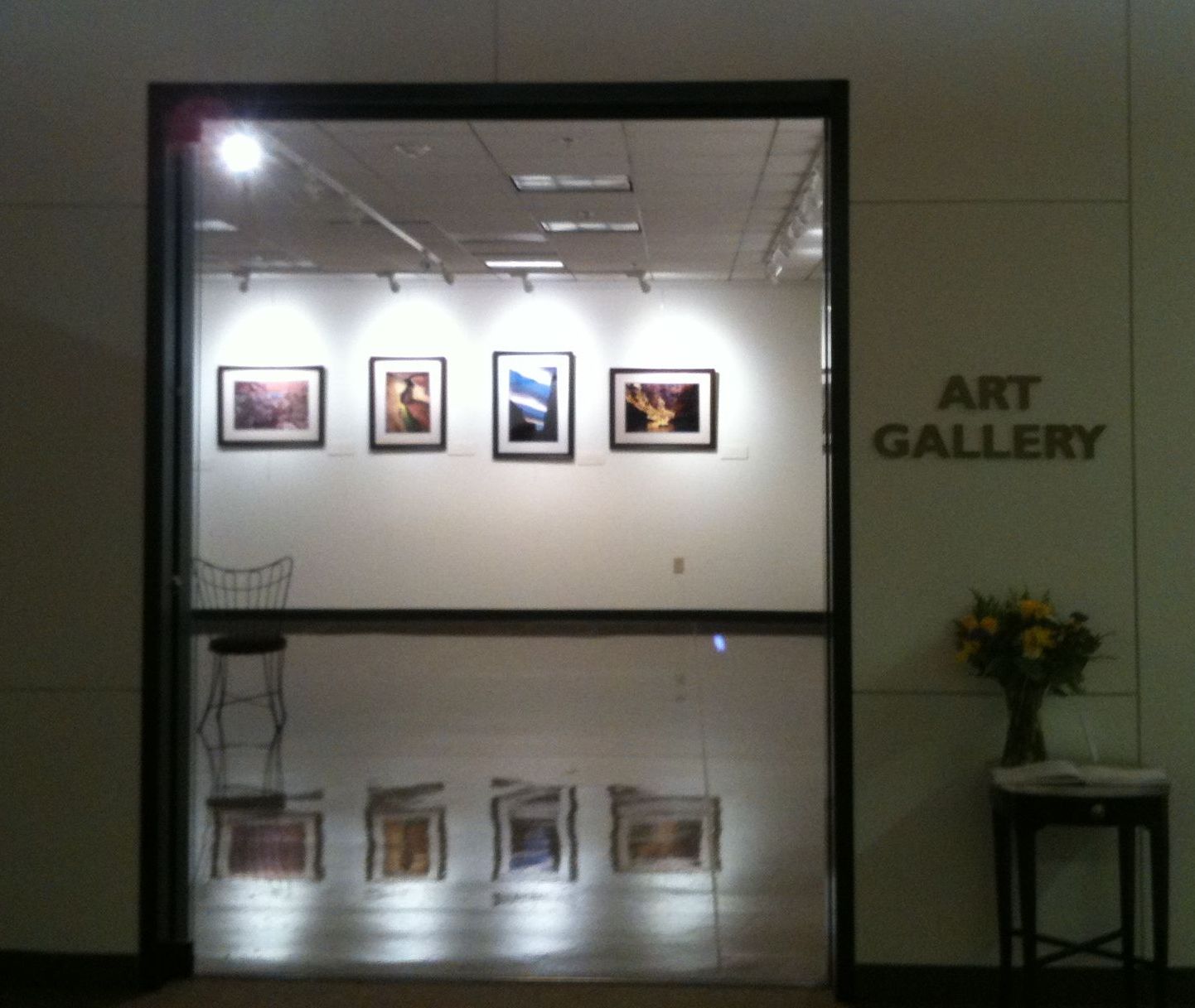 The art gallery in Peoria City Hall opened on January 22, 2011. The first exhibit is Lasting Light: 125 Years of Grand Canyon Photography. We didn't make it to the opening ceremony but did stop by after breakfast. The attendants said the morning turnout was about 65 people and one of the photographers, Mike Buchheit, was there to speak.
 The art gallery is a small corner room of City Hall so only half of the photographs are currently on display. They plan to switch out the photos sometime in March so we can come back and see the remainder. There are 26 total artists featured among the 60 photographs. Those on display right now include works from: Jack Dykinga, Gary Ladd, Mike Buchheit, John Blaustein, John Running, Sue Bennett, Jerry Jacka, Michael Collier, Larry Ulrich, and more.
For biographies and more information on the photographers check out the Grand Canyon Association website at this link
I particularly liked John Running's Bennett at Matkatamiba Canyon featuring his partner Sue Bennett's shadow as she bent to drink from the water in the canyon. This is one that has stayed with me since viewing the display. Because it's the shadow of the person, it has a timeless quality and reminds me of the surreal quality of light and darkness I've experienced in the canyon. The shadows hold secrets we can only imagine.
The photos take you through the canyon, from top to bottom and from airplane to foot to dory to kayak. It's definitely worth the time to head over to Peoria City Hall to check it out. And if you have a trip planned to the Grand Canyon (like we do in May), this will definitely spike your excitement!
For more details see my last post on this: Grand Canyon Goes on the Road
Flat Iron Follow-up: Still one of the toughest
Thanksgiving of 2009 I first hiked to the top of Flat Iron and determined it was the toughest hike within a 30 minute drive of downtown Phoenix. You can read all about the trail stats and my first hike here: Flat Iron: One of toughest hikes!
On December 11, 2010 we embarked on our second journey to the top of Flat Iron. My goal was to successfully make it to the top and back down with no injuries, including the Charlie horse calf cramps that besieged me the previous year.
I also took the time to snap a few additional photos of the trail so you can see what you might be getting in to as you start this journey yourself.
The trail was heavily traveled this day in December, I believe I read somewhere that a local hiking Meetup group was hiking the trail that day. We ran into numerous traffic jams as a result.
Since the drive to the Lost Dutchman Trailhead is over an hour from our home in Peoria, AZ we were not among the first to arrive at the trail. We started our hike 11am with an expectation that it would take us until dark like it did the year before. So, lucky for us we experienced the most traffic jams (it seemed like the Meetup must have had more than 30 people!) on the way up as most of this group was descending around the time we were hitting our stride up the hardest part of the trail.
A few things that you may want to take note of. After a long drive to the trailhead your bladder might be in need of some attention. There is a bathroom at the campground, near the trailhead. You will start on the Discovery trail from the trailhead but instead of turning on the Siphon Draw trail, keep going straight to the campground. A full-on restroom facility awaits less than 1/4 of a mile from the Lost Dutchman trailhead parking lot.


Not long after you start your hike down Siphon Draw trail you'll need to pass through two sets of gates, one wooden and one metal. I usually question my direction when I have to pass through gates, but this is indeed the way!

From here the trail looks long across the desert. The incline is steady and when you turn back from time to time you'll realize just how much that steady grade adds up.


Quickly you'll realize the sides of the desert are closing in on you, you're becoming shrouded in shadows. You are now within a canyon, no longer the expansive desert.

The trail becomes increasingly narrower until you hit the slickrock basin which ends the Siphon Draw portion of the trail.

From here, to get to the top of Flat Iron you must navigate up through the boulders, engaging your entire body to determine the best route up and looking down from time to time to mark your progress.

On your way look out for markers such as blue or red dots and spray-painted arrows. They will help find the best traveled paths.

Finally you'll reach the last series of rocks you need to pass before reaching the top of Flat Iron, this one is tricky and you'll need to pay careful attention to how you choose your route. (On the way up we found using the rocks was best, on the way down we found the tree to be a great hand hold.)


Up above the rock wall you'll see a marker letting you know which way is which. This year we went towards the left so we could take picture of Flat Iron's face and experience a different view than the previous year.


On the way down we ran into a mom and daughter who were moving pretty slowly. The mom said she was "overtired" and was taking her time. We had passed these two at the top when we were going up the wall and they were coming down. Their descent had taken them much much longer due to tired muscles. The slickrock basin can be a tough one on those tired muscles that need to keep you upright as you descend the slippery slope. They made it down but keep this in mind. You can easily underestimate the time and energy this hike may take. As Ed Viesturs says "Getting up is optional, but getting down is mandatory" Make sure you have enough reserved energy to get back down from wherever you are. And take enough water, and a flashlight just in case!

Thankfully for us, we made it up and down with no problems; no calf cramps, no lack of water. And we improved on our time, making it down before 5pm in time for a beer and an artery busting snack from a local bar and grill!
The Grand Canyon goes on the road:
Earlier this week I read that a collection of Grand Canyon photographs showcasing 125 years of history will be on display at the Peoria Art Museum in Arizona. I'm excited to check out the grand opening of Lasting Light: 125 Years of Grand Canyon Photography on January 22nd since it's just a few miles from my home and a few months before my next backpacking trip down into the Canyon.
The collection has been on the road the past two years starting in Arizona and swinging through Wyoming, Georia, Missouri, Arkansas, Nebraska, and Illinois. Don't worry if you missed those, after three months with us in Arizona it will be back on the road to South Carolina, Pennsylvania, Colorado, Texas, and California.
For detail about where and when to see the exhbition while it's in Peoria, AZ check out: City of Peoria and for background and the schedule through 2013 check out: Smithsonian Institution Traveling Exhibition Service
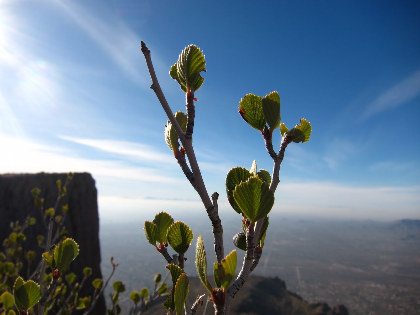
Here's a photo of my own from the North Rim in August 2008.

The collection has been on the road the past two years starting in Arizona and swinging through Wyoming, Georia, Missouri, Arkansas, Nebraska, and Illinois. Don't worry if you missed those, after three months with us in Arizona it will be back on the road to South Carolina, Pennsylvania, Colorado, Texas, and California.
For detail about where and when to see the exhbition while it's in Peoria, AZ check out: City of Peoria and for background and the schedule through 2013 check out: Smithsonian Institution Traveling Exhibition Service
Here's a photo of my own from the North Rim in August 2008.

Subscribe to:
Posts (Atom)